


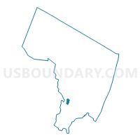
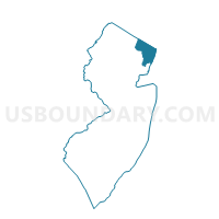
Wood-Ridge borough voting district 5, Bergen County, New Jersey
About
Outline

Summary
| Unique Area Identifier | 616906 |
| Name | Wood-Ridge borough voting district 5 |
| County | Bergen County |
| State | New Jersey |
| Area (square miles) | 0.45 |
| Land Area (square miles) | 0.45 |
| Water Area (square miles) | 0.00 |
| % of Land Area | 100.00 |
| % of Water Area | 0.00 |
| Latitude of the Internal Point | 40.85639970 |
| Longtitude of the Internal Point | -74.09307930 |
Maps

Graphs
Select a template below for downloading or customizing gragh for Wood-Ridge borough voting district 5, Bergen County, New Jersey


Neighbors
Neighoring Voting District (by Name) Neighboring Voting District on the Map
- Carlstadt borough voting district 5, Bergen County, NJ
- Hasbrouck Heights borough voting district 1, Bergen County, NJ
- Hasbrouck Heights borough voting district 2, Bergen County, NJ
- Hasbrouck Heights borough voting district 3, Bergen County, NJ
- Lodi borough voting district 4, Bergen County, NJ
- Lodi borough voting district 5, Bergen County, NJ
- South Hackensack township voting district 1, Bergen County, NJ
- Wallington borough voting district 6, Bergen County, NJ
- Wood-Ridge borough voting district 1, Bergen County, NJ
- Wood-Ridge borough voting district 3, Bergen County, NJ
Top 10 Neighboring County Subdivision (by Population) Neighboring County Subdivision on the Map
- Lodi borough, Bergen County, NJ (24,136)
- Hasbrouck Heights borough, Bergen County, NJ (11,842)
- Wallington borough, Bergen County, NJ (11,335)
- Wood-Ridge borough, Bergen County, NJ (7,626)
- Carlstadt borough, Bergen County, NJ (6,127)
- South Hackensack township, Bergen County, NJ (2,378)
Top 10 Neighboring Place (by Population) Neighboring Place on the Map
- Lodi borough, NJ (24,136)
- Hasbrouck Heights borough, NJ (11,842)
- Wallington borough, NJ (11,335)
- Wood-Ridge borough, NJ (7,626)
- Carlstadt borough, NJ (6,127)
Top 10 Neighboring Elementary School District (by Population) Neighboring Elementary School District on the Map
Top 10 Neighboring Secondary School District (by Population) Neighboring Secondary School District on the Map
Top 10 Neighboring Unified School District (by Population) Neighboring Unified School District on the Map
- Lodi Borough School District, NJ (24,136)
- Hasbrouck Heights Borough School District, NJ (11,842)
- Wallington Borough School District, NJ (11,335)
- Wood-Ridge Borough School District, NJ (7,626)
Top 10 Neighboring State Legislative District Lower Chamber (by Population) Neighboring State Legislative District Lower Chamber on the Map
Top 10 Neighboring State Legislative District Upper Chamber (by Population) Neighboring State Legislative District Upper Chamber on the Map
Top 10 Neighboring 111th Congressional District (by Population) Neighboring 111th Congressional District on the Map
Top 10 Neighboring Census Tract (by Population) Neighboring Census Tract on the Map
- Census Tract 600, Bergen County, NJ (7,694)
- Census Tract 304, Bergen County, NJ (7,282)
- Census Tract 50, Bergen County, NJ (6,127)
- Census Tract 252, Bergen County, NJ (5,768)
- Census Tract 303, Bergen County, NJ (4,460)
- Census Tract 571.01, Bergen County, NJ (4,168)
Top 10 Neighboring 5-Digit ZIP Code Tabulation Area (by Population) Neighboring 5-Digit ZIP Code Tabulation Area on the Map
- 07026, NJ (30,555)
- 07644, NJ (24,136)
- 07604, NJ (11,842)
- 07057, NJ (11,335)
- 07075, NJ (7,626)
- 07072, NJ (6,127)